|
||
 |
||
|
Missouri, the "Show-Me
State"
Abbreviation: MO |
||
|
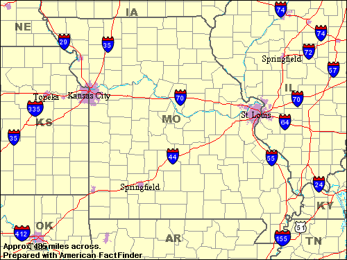
Its name is an Algonquin Indian term meaning "river of the big canoes." Missouri was organized as a territory in 1812 and was admitted to the Union as the 24th state in 1821. Missouri is called the "Show-Me State," because its people have a reputation for believing only what they see. Its location and its two great rivers have made the state a transportation hub. The mighty Mississippi River forms Missouri's eastern border. The wide Missouri River winds across the state from west to east. A wealth of food, manufactured products and raw materials is shipped on these waterways, the nation's two longest rivers. Missouri has abundant wildlife, rugged hills, rushing streams and peaceful woodlands to delight hunters, hikers and photographers. The writer Samuel Clemens, known as Mark Twain, was a son of Missouri; museums in Hannibal, his home town, celebrate his works. GOVERNMENT Population (July 2001): 5,637,309; National Rank: 17; Percent change since April 2000: .6% Land Area: 68,898 sq mi. (178,446 sq km); National Rank: 21 10 largest cities (2000): Kansas City, 441,545; St. Louis, 348,189; Springfield, 151,580; Independence, 113,288; Columbia, 84,531; St. Joseph, 73,990; Lee's Summit, 70,700; St. Charles, 60,321; St. Peter's, 51,381; Florissant, 50,497 ECONOMY |
||
|
DISCLAIMER Any reference obtained from this server to a specific commercial product, process, or service does not constitute or imply an endorsement by the United States Government of the product, process, or service, or its producer or provider. The views and opinions expressed in any referenced document do not necessarily state or reflect those of the United States Government. |
|
U.S. Diplomatic Mission to Germany
/Public Affairs/ Information Resource Centers Updated: February 2004 |

